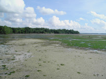
When I covered the chapter on Weather and Climate, I spoke about 3 elements of weather, namely temperature, rainfall, and wind.
However, there are actually a number of other elements which are not mentioned at all in your textbook. This post will introduce one of these other elements: sunlight.
One thing you'll need to know for your exam is the way in which these 4 elements of weather are interrelated. In other words, how do these elements affect one another?
Sunlight affects temperature. The more sunlight an area receives, the higher the temperature.
Wind and rainfall also affect temperature, but in a different way. The stronger the wind, or the higher the rainfall, the lower the temperature. This is why the air tends to be cooler on windy or rainy days.
Temperature can also affect wind. Higher temperature means that the air is warmed and rises, creating an area of low pressure. The higher the temperature, the warmer the air is, creating an area of very low pressure. Likewise, the lower the temperature, the colder the air is, creating an area of very high pressure. The greater the difference in pressure, the stronger the wind. So strong winds can be formed if you have warm areas of very low pressure close to cool areas of very high pressure .
And lastly, temperature can affect rainfall. Higher temperatures lead to an increase in evaporation, thus resulting to an increase in the amount of water vapour in the atmosphere. More water vapour present in the atmosphere ultimately leads to an increase in rainfall.
Monday, 1 October 2007

How latitude and altitude affect temperature...
***IMPORTANT! THIS IS IN THE EXAM!***
How does latitude affect temperature?
We all know by now that the Earth can be broadly divided into 3 climate types: tropical, temperate and polar. We also know by now that the further we travel from the Equator, the colder it gets. Hence, at the high latitudes, close to 90° North and South, temperatures are much lower than at the Equator.
Why is this so? Why is the temperature in Singapore so different from that in Greenland?
There are various reasons for this. The most important one has to do with what is known as the angle of solar incidence. Angle of solar incidence refers to the angle at which the Sun's rays strike the Earth's surface.

At the Equator, the incoming solar radiation strikes the Earth at a right angle. Hence the heat from the Sun is concentrated and more intense, and is spread over a small area. Also, at this latitude, the Sun's rays travel a short distance through the atmosphere. Because of the shorter distance travelled, Less heat is lost to the atmosphere, and therefore more of the Sun's rays reach the Earth's surface.
On the other hand, at high latitudes, the incoming solar radiation strikes the Earth at an acute angle. The Sun's rays also have to pass through a longer distance in the atmosphere before reaching the Earth's surface. Hence more heat is lost to the atmosphere. Even though the rays which strike the polar regions carry the same amount of heat as the rays which strike the tropical regions, this heat is diffused and dispersed over a large area.
Let's use a flashlight as an analogy:

A represents the Sun's rays hitting the Earth at the Equator. The heat is focused and concentrated over a small area and is more intense.
B represents the Sun's rays hitting the Earth at the North Pole. The heat is diffused and dispersed over a larger area.
I hope you remember that in primary school, you learned that it is hottest at midday, when the Sun is directly overhead, whereas it is cooler in the morning and evenings, when the Sun is lower in the sky. This is the same general principle by which latitude affects temperature.
In summary:
• At different latitudes, the Sun's rays strike the Earth at different angles
• At the Equator, the Sun's rays strike the Earth at a right angle, hence the heat is more intense and concentrated over a small area. Less heat is lost to the atmosphere as the rays travel a shorter distance through the atmosphere.
• At the poles, the Sun's rays strike the Earth at an acute angle, dispersing and diffusing the heat over a larger area. More heat is lost to the atmosphere as the rays travel a longer distance through the atmosphere.
One final note: While it is hot and wet in the tropical regions, it is cold in the polar regions, so cold that most of the precipitation is frozen, and falls as snow.
How does altitude affect temperature?

In actual fact, the atmosphere is NOT warmed by direct contact with the Sun's rays. What really happens is that the Earth's surface absorbs most of the heat. Then, as the Earth's surface warms up, the heat diffuses into the lower layers of the atmosphere, warming it, which in turn transfers some of the heat to the upper layers of the atmosphere.

Of course, this means that the layers of atmosphere closest to the Earth's surface receive the most heat from the Earth's surface.
What happens at high altitudes, such as on mountains, or in the upper layers of the atmosphere, is that at such great height, far from the Earth's surface, there is very little heat reaching this altitude. Most of the heat is being trapped within the lower layers of the atmosphere close to the Earth's surface.
Try and visualise a thermos flask with several layers of cloth wrapped around it. The thermos flask represents the Earth, warmed by heat from the Sun. The layers of cloth represent the layers of the atmosphere, with the layers of cloth closest to the thermos flask representing the layers of atmosphere closest to the Earth's surface. The layers of cloth on the outside would be much cooler, because most of the heat from the thermos flask is trapped in the inner layers of cloth.
In summary:
• The atmosphere is progressively warmed by the heat radiating from the Earth's surface
• The lower layers of the atmosphere closest to the Earth's surface are warmed first, and then subsequently transfer heat to the upper layers. As the heat is transferred upwards, some heat is continuously being lost.
• At high altitudes, there is very little heat left to be transferred at this height.
EOY Exam: Hints
For those of you who have lost the handout I gave out with the list of chapters and sections to emphasise on for the exams (frankly, I'm not surprised if some of you don't even know what I'm talking about), I'm repeating the list here:
Chapter 1: About Geography
• What the study of Geography is about (pgs. 4–5)
• Physical and human environment (pg. 6)
Chapter 2: Earth as Our Home
• Earth as part of the Solar System (pgs. 16–19)
• Earth – Our Provider (pgs. 22–25)
Chapter 3: Physical and Human Environments
• Differences between physical and human environment* (pgs. 30–31)
• Inter-relationships between people and the environment* (pgs. 32–36)
• Case Study: Way of life of the people living in Irian Jaya and Papua New Guinea, compared to the way of life of people living in Singapore* (pgs. 37–41)
Chapter 4: Environments Through Maps
• Latitudes and Longitudes (pgs. 49 – 50)
• Reading topographical maps* (pgs. 56–67)
Chapter 7: Landforms and Rocks
• Structure of the Earth, and how it is being shaped (pgs. 90–91)
• Fold mountains and their formation* (pgs. 101 –102)
• Types of rocks (pgs. 103–105)
• Weathering & erosion* (pgs. 109–112)
Chapter 8: Rivers
• Hydrologic cycle* (pgs. 120–121)
• River systems (pgs. 122–123)
• Rivers and people: Energy* (pgs. 132–133)
Chapter 9: Weather and Climate
• Factors affecting weather and climate (e.g, latitude, altitude)
• Elements of weather and climate* (temperature, rainfall and wind), and how we measure them. (pgs. 142–151)
• Different climatic types (pg. 153)
• Reading climographs* (pg. 153)
Chapter 10: Natural Vegetation
• Relationship between climate and natural vegetation (pgs. 160–161)
• Tropical rainforest and its structure* (pgs. 164–165)
• Case Study: Bukit Timah Nature Reserve* (pgs. 166–169)
• Vegetation of the tropical savannah (pgs. 174–175)
• Natural vegetation and people (pg. 181)
Chapter 1: About Geography
• What the study of Geography is about (pgs. 4–5)
• Physical and human environment (pg. 6)
Chapter 2: Earth as Our Home
• Earth as part of the Solar System (pgs. 16–19)
• Earth – Our Provider (pgs. 22–25)
Chapter 3: Physical and Human Environments
• Differences between physical and human environment* (pgs. 30–31)
• Inter-relationships between people and the environment* (pgs. 32–36)
• Case Study: Way of life of the people living in Irian Jaya and Papua New Guinea, compared to the way of life of people living in Singapore* (pgs. 37–41)
Chapter 4: Environments Through Maps
• Latitudes and Longitudes (pgs. 49 – 50)
• Reading topographical maps* (pgs. 56–67)
Chapter 7: Landforms and Rocks
• Structure of the Earth, and how it is being shaped (pgs. 90–91)
• Fold mountains and their formation* (pgs. 101 –102)
• Types of rocks (pgs. 103–105)
• Weathering & erosion* (pgs. 109–112)
Chapter 8: Rivers
• Hydrologic cycle* (pgs. 120–121)
• River systems (pgs. 122–123)
• Rivers and people: Energy* (pgs. 132–133)
Chapter 9: Weather and Climate
• Factors affecting weather and climate (e.g, latitude, altitude)
• Elements of weather and climate* (temperature, rainfall and wind), and how we measure them. (pgs. 142–151)
• Different climatic types (pg. 153)
• Reading climographs* (pg. 153)
Chapter 10: Natural Vegetation
• Relationship between climate and natural vegetation (pgs. 160–161)
• Tropical rainforest and its structure* (pgs. 164–165)
• Case Study: Bukit Timah Nature Reserve* (pgs. 166–169)
• Vegetation of the tropical savannah (pgs. 174–175)
• Natural vegetation and people (pg. 181)
Monday, 17 September 2007
Tropical Savanna: Migration of the herbivores
As all of you should be aware of by now, the tropical grasslands of the world are home to an extremely rich variety of large mammals. Nowhere else is this diversity more apparent than in tropical Africa, where close to 50 different species of antelope, of all shapes, sizes and habits, along with numerous other large herbivores, inhabit various parts of the savannas that span the continent. And this diversity of herbivores feeds a wide variety of carnivores.
Note that not all of the creatures one can find in the savanna are 'true' savanna species; many of them actually prefer forest, but can be found in mixed habitats, such as in areas where the tropical rainforest slowly makes way for woodland, and subsequently turns into savanna. Many of these forest-dwelling animals are also occasionally found in savanna habitat adjacent to the forests where they would normally live. And some of these actually live within the savanna, wherever there is sufficient dense vegetation, bush, or thickets to hide in, such as in gallery forest, which refers to forests that grow along the banks of rivers in areas where it would otherwise be too dry for forest to grow.
By and large, however, the majority of large antelope are savanna inhabitants. Many are adapted to grazing on the grasses, herbs, and other low-growing plants. Others are browsers, choosing to nibble on tender young leaves and shoots from bushes, shrubs and trees. This way, competition between species is minimised, as each species has its own particular preference where it comes to food and habitat. The savanna may seem like a broad, homogeneous space to us, but there is a wide variety of microhabitats and ecological niches available for herbivores to exploit.
One thing that most of the larger savanna-dwelling herbivores have in common is a tendency to live in large herds. Living in large herds has its advantages, and it mostly has to do with avoiding predators. First of all, if you live in a herd, there are so many more pairs of eyes and ears on the alert for any sign of danger. Secondly, if a predator attacks, the fact that there are so many potential targets to choose from means that the likelihood of you becoming the main course for the resident lions or hyenas is so much lesser.
Due to the seasonal nature of the savanna, there are very distinct dry and wet seasons in most tropical grasslands. This has implications for the large numbers of herbivores which depend on an adequate supply of water and grazing. Many of these antelope are tough, and adapted to survive with little water and poor-quality food. These tend to stay put during the dry season. However, there are many other species which depend on having frequent access to water, and depend on tender young grass. When the dry season comes, these herbivores will migrate in huge herds, abandoning their former haunts for new pastures, travelling wherever the rain brings water and fresh green grass.
Migration is such an important part of these animals' lives that in many species, calves must learn to stand up and run with the herd within days or even hours of their birth. For wildebeest, mothers even synchronise their births as well; all will drop their calves within a short span of 2 to 3 weeks. Birth is timed to coincide with the rainy season, as well as to completely overwhelm the local predators so that overall survival rate of newborn calves is higher.
These herds may number in the thousands or even millions, all engaged in the tireless quest for food and water. Migration takes its toll, and many will perish; predators will bring down a few, whereas for others, the exhaustion and strain will be too much to bear. Where migration routes bring the herds across rivers, the death toll can be even higher, and it's not just due to the hungry Nile crocodiles that lie in wait in the water. Many of these rivers have only a few entry and exit points along the steep riverbanks, and for the thousands of hungry and thirsty herbivores, these few spots along the river banks become chokepoints. In the ensuing stampedes, many will be trampled, or drown in the waters from sheer exhaustion.
Wildebeest Migration
All over the tropical savannas of Africa, this beautiful yet harsh drama of life and death has played out for eons, with mighty herds perpetually on the move, chasing the rainclouds in a never-ending quest for fresh grass and water. Today however, many of these migrations are no more; hunting and development has decimated many of the great herds, whereas in some areas, the herds find their old migration routes blocked off with fences and development.
One of the last places where you can still see a surviving example of the great herbivore migrations is in East Africa. Here, more than a million wildebeest, and thousands of zebra and antelope make an annual journey, travelling from the Masai Mara Game Reserve in Kenya to the Serengeti National Park in neighbouring Tanzania, and back again later in the year.
Wildebeest Migration Made Simple
Serengeti Wildebeest Migration route map
This phenomenon attracts countless tourists, who pay to witness first-hand the migration of nearly 1.4 million wildebeest, 360,000 Thomson's gazelle, and nearly 200,000 zebra.
Here's a few more videos that capture the essence of life on the tropical savanna, and show us a slice of the awe-inspiring wildlife spectacle that is the Masai Mara-Serengeti migration:
Note that not all of the creatures one can find in the savanna are 'true' savanna species; many of them actually prefer forest, but can be found in mixed habitats, such as in areas where the tropical rainforest slowly makes way for woodland, and subsequently turns into savanna. Many of these forest-dwelling animals are also occasionally found in savanna habitat adjacent to the forests where they would normally live. And some of these actually live within the savanna, wherever there is sufficient dense vegetation, bush, or thickets to hide in, such as in gallery forest, which refers to forests that grow along the banks of rivers in areas where it would otherwise be too dry for forest to grow.
By and large, however, the majority of large antelope are savanna inhabitants. Many are adapted to grazing on the grasses, herbs, and other low-growing plants. Others are browsers, choosing to nibble on tender young leaves and shoots from bushes, shrubs and trees. This way, competition between species is minimised, as each species has its own particular preference where it comes to food and habitat. The savanna may seem like a broad, homogeneous space to us, but there is a wide variety of microhabitats and ecological niches available for herbivores to exploit.
One thing that most of the larger savanna-dwelling herbivores have in common is a tendency to live in large herds. Living in large herds has its advantages, and it mostly has to do with avoiding predators. First of all, if you live in a herd, there are so many more pairs of eyes and ears on the alert for any sign of danger. Secondly, if a predator attacks, the fact that there are so many potential targets to choose from means that the likelihood of you becoming the main course for the resident lions or hyenas is so much lesser.
Due to the seasonal nature of the savanna, there are very distinct dry and wet seasons in most tropical grasslands. This has implications for the large numbers of herbivores which depend on an adequate supply of water and grazing. Many of these antelope are tough, and adapted to survive with little water and poor-quality food. These tend to stay put during the dry season. However, there are many other species which depend on having frequent access to water, and depend on tender young grass. When the dry season comes, these herbivores will migrate in huge herds, abandoning their former haunts for new pastures, travelling wherever the rain brings water and fresh green grass.
Migration is such an important part of these animals' lives that in many species, calves must learn to stand up and run with the herd within days or even hours of their birth. For wildebeest, mothers even synchronise their births as well; all will drop their calves within a short span of 2 to 3 weeks. Birth is timed to coincide with the rainy season, as well as to completely overwhelm the local predators so that overall survival rate of newborn calves is higher.
These herds may number in the thousands or even millions, all engaged in the tireless quest for food and water. Migration takes its toll, and many will perish; predators will bring down a few, whereas for others, the exhaustion and strain will be too much to bear. Where migration routes bring the herds across rivers, the death toll can be even higher, and it's not just due to the hungry Nile crocodiles that lie in wait in the water. Many of these rivers have only a few entry and exit points along the steep riverbanks, and for the thousands of hungry and thirsty herbivores, these few spots along the river banks become chokepoints. In the ensuing stampedes, many will be trampled, or drown in the waters from sheer exhaustion.
Wildebeest Migration
All over the tropical savannas of Africa, this beautiful yet harsh drama of life and death has played out for eons, with mighty herds perpetually on the move, chasing the rainclouds in a never-ending quest for fresh grass and water. Today however, many of these migrations are no more; hunting and development has decimated many of the great herds, whereas in some areas, the herds find their old migration routes blocked off with fences and development.
One of the last places where you can still see a surviving example of the great herbivore migrations is in East Africa. Here, more than a million wildebeest, and thousands of zebra and antelope make an annual journey, travelling from the Masai Mara Game Reserve in Kenya to the Serengeti National Park in neighbouring Tanzania, and back again later in the year.
Wildebeest Migration Made Simple
Serengeti Wildebeest Migration route map
This phenomenon attracts countless tourists, who pay to witness first-hand the migration of nearly 1.4 million wildebeest, 360,000 Thomson's gazelle, and nearly 200,000 zebra.
Here's a few more videos that capture the essence of life on the tropical savanna, and show us a slice of the awe-inspiring wildlife spectacle that is the Masai Mara-Serengeti migration:
Some nice videos of waterfalls
Here are a couple of nice little video clips, showing footage of a couple of the world's most famous waterfalls.
First up, we have a snippet from the Planet Earth documentary series, featuring Angel Falls, situated on a tributary of the Carrao River in Venezuela, South America.
http://en.wikipedia.org/wiki/Angel_falls*
And here, we have Victoria Falls, which lies on the Zambezi River between the countries of Zambia and Zimbabwe in southern Africa.
http://en.wikipedia.org/wiki/Victoria_falls*
*(Note: Because Wikipedia can be edited by anybody with Internet access and plenty of spare time, Wikipedia is not always the most accurate and reliable source of information. Vandalism and even blatant planting of misinformation can occur in any article. I would recommend that before immediately accepting the contents of any Wikipedia entry as fact, one should check the article for references, and verify the accuracy of the information first)
First up, we have a snippet from the Planet Earth documentary series, featuring Angel Falls, situated on a tributary of the Carrao River in Venezuela, South America.
http://en.wikipedia.org/wiki/Angel_falls*
And here, we have Victoria Falls, which lies on the Zambezi River between the countries of Zambia and Zimbabwe in southern Africa.
http://en.wikipedia.org/wiki/Victoria_falls*
*(Note: Because Wikipedia can be edited by anybody with Internet access and plenty of spare time, Wikipedia is not always the most accurate and reliable source of information. Vandalism and even blatant planting of misinformation can occur in any article. I would recommend that before immediately accepting the contents of any Wikipedia entry as fact, one should check the article for references, and verify the accuracy of the information first)
Thursday, 6 September 2007
Common Test II Qn 14.
a. (i) Name the instrument shown in Fig. 3.
Stevenson screen
(ii) Explain why this instrument has louvres on its side and why it is always set above ground.
The louvres are there to allow air to pass through.
It is set above the ground so that it would not be affected by heat from the ground.
These features help to ensure that the readings from the six's thermometer in the box are as accurate as possible.
b. (i) Where is the best place to put a rain gauge?
D
(ii) Give two reasons for your choice on why it is the best location.
D is an open area and grass is a poor conductor of heat; this ensures that the rain gauge would not be overheated and cause evaporation of rainfall collected
(iii) Explain why the other locations are not ideal.
A is located near an obstruction, in this case a building
B is located near obstructions such as trees and a building
C is located close to trees, also an obstruction.
All these would affect the amount of rain collected.
c. Define the term 'temperature' and state two factors that will affect it.
Temperature is the degree of hotness and coldness of the air. Altitude, latitude and time of day affect temperature. (pg. 142)
Stevenson screen
(ii) Explain why this instrument has louvres on its side and why it is always set above ground.
The louvres are there to allow air to pass through.
It is set above the ground so that it would not be affected by heat from the ground.
These features help to ensure that the readings from the six's thermometer in the box are as accurate as possible.
b. (i) Where is the best place to put a rain gauge?
D
(ii) Give two reasons for your choice on why it is the best location.
D is an open area and grass is a poor conductor of heat; this ensures that the rain gauge would not be overheated and cause evaporation of rainfall collected
(iii) Explain why the other locations are not ideal.
A is located near an obstruction, in this case a building
B is located near obstructions such as trees and a building
C is located close to trees, also an obstruction.
All these would affect the amount of rain collected.
c. Define the term 'temperature' and state two factors that will affect it.
Temperature is the degree of hotness and coldness of the air. Altitude, latitude and time of day affect temperature. (pg. 142)
Common Test II Qn 13.
a. (i) What are floodplains?
Floodplains are flat land alongside a river that is covered by water during a flood.
(ii) Explain why many people choose to live on floodplains.
They can get easy access to water and use the fertile soil for farming.
b. How are rivers useful in agricultural activities?
• Dams built to produce hydro-electricity also store water for farmers to irrigate their crops.
• Stored water can allow farmers to grow an extra crop in a dry season
• Reduce the effects of drought
• Enable the transport of stored water to areas where water is needed urgently (pg. 134)
c. (i) What are the three main tributaries of the River Nile?
Blue Nile, White Nile, Atbara (pg. 135)
(ii) Describe the advantages of the Aswan High Dam on the River Nile.
These are the advantages:
• No more floods in Egypt
• More land is irrigated, producing more food
• Electricity is produced from the hydro-electric station
• Lake Nasser can be used by large boats for transport
• Supports a fishing industry (pg. 137)
Floodplains are flat land alongside a river that is covered by water during a flood.
(ii) Explain why many people choose to live on floodplains.
They can get easy access to water and use the fertile soil for farming.
b. How are rivers useful in agricultural activities?
• Dams built to produce hydro-electricity also store water for farmers to irrigate their crops.
• Stored water can allow farmers to grow an extra crop in a dry season
• Reduce the effects of drought
• Enable the transport of stored water to areas where water is needed urgently (pg. 134)
c. (i) What are the three main tributaries of the River Nile?
Blue Nile, White Nile, Atbara (pg. 135)
(ii) Describe the advantages of the Aswan High Dam on the River Nile.
These are the advantages:
• No more floods in Egypt
• More land is irrigated, producing more food
• Electricity is produced from the hydro-electric station
• Lake Nasser can be used by large boats for transport
• Supports a fishing industry (pg. 137)
Subscribe to:
Posts (Atom)